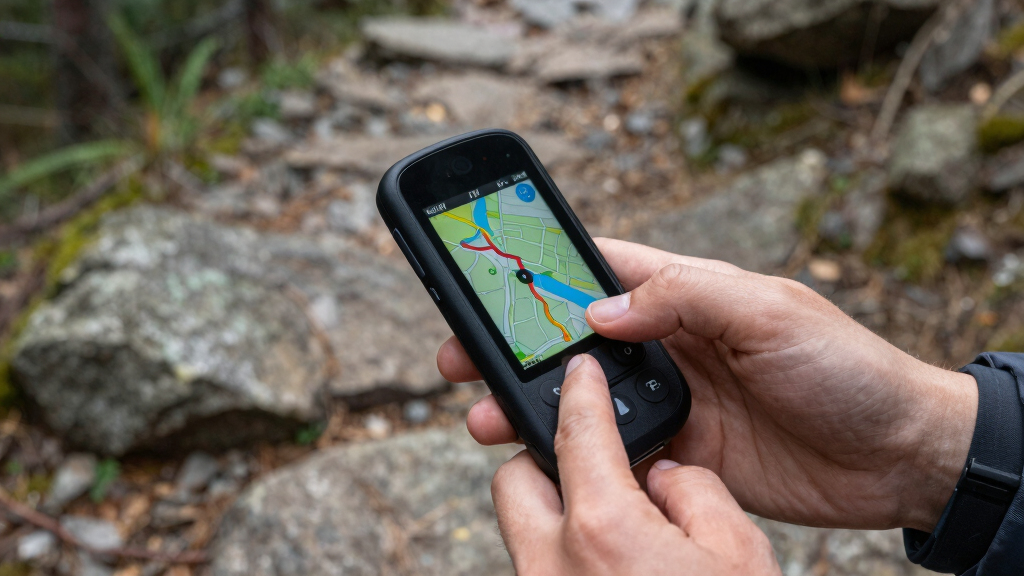

If you’re searching for the best handheld GPS units for hiking off-bike, you’re looking for reliable navigation tools that can handle rugged terrains and extended use. The Garmin eTrex® SE stands out as the overall best choice for its balance of battery life, multi-GNSS support, and sunlight-readable screen. The Garmin GPSMAP 64sx offers preloaded topo maps for detailed terrain navigation, while the Garmin eTrex 10 provides a budget-friendly option for casual hikers. Each device has tradeoffs, like battery longevity versus map detail or ruggedness versus ease of use. Continue reading to see how these options compare and find the best fit for your hiking adventures.
Key Takeaways
- Top-ranked devices combine long battery life with multi-satellite support for reliable off-grid navigation.
- Ruggedness and water resistance are essential for durability in challenging outdoor conditions.
- Preloaded topographic maps significantly enhance route planning without additional purchases.
- Ease of use and interface clarity are critical for quick decision-making during hikes.
- Higher-priced models tend to offer better screen readability and multi-band satellite technology, but budget options can suffice for casual use.


More Details on Our Top Picks
Garmin eTrex® SE GPS Handheld Navigator, Extra Battery Life, Wireless Connectivity, Multi-GNSS Support, Sunlight Readable Screen, Black/Yellow (Renewed)
This model stands out as the best all-around choice for off-bike hiking due to its impressive battery life—up to 168 hours in standard mode—and a sunlight-readable 2.2″ display, making it ideal for extended day trips. Compared with the Garmin GPSMAP 64sx, the eTrex SE offers significantly longer battery endurance, though it sacrifices some advanced mapping features. Its support for multiple GNSS systems ensures reliable positioning even in challenging terrains, and wireless connectivity lets you update maps or sync with the Garmin Explore app easily. Tradeoffs include a smaller, monochrome screen compared to the color display of the GPSMAP 64sx, and the absence of built-in topographic maps. This pick makes the most sense for hikers who prioritize endurance and visibility over detailed mapping.
Pros:- Exceptional battery life suitable for multi-day hikes
- Sunlight-readable high-resolution display
- Supports multiple GNSS systems for reliable positioning
- Wireless connectivity for updates and trip planning
Cons:- No preloaded maps, requiring external map loading
- Monochrome display offers less visual detail than color screens
- Requires AA batteries, which may be less convenient for some users
Best for: Long-distance hikers needing extended battery life and clear daytime screen visibility
Not ideal for: Users who require detailed topographic maps or multi-function navigation features
- Screen Size:2.16 Inches
- Battery Life:168 Hours
- Display Type:Transflective, Monochrome
- GNSS Support:GPS, GLONASS, Galileo, BeiDou, QZSS
- Water Resistance:IPX7
- Connectivity:Wireless, Bluetooth, USB
Bottom line: This device is perfect for hikers who want a dependable, easy-to-read navigator with long-lasting power for extended trips.
Garmin 010-02258-10 GPSMAP 64sx, Handheld GPS with Altimeter and Compass, Preloaded with TopoActive Maps, Black/Tan
The GPSMAP 64sx is tailored for outdoor enthusiasts who need a rugged device with comprehensive mapping features, including preloaded TopoActive maps and a high-sensitivity quad helix antenna for precise positioning. It’s a step up from the Garmin eTrex SE in terms of built-in map capabilities, making it suitable for those who want ready-to-use topographic data without external loading. The device’s durability—water-resistant and with button operation—makes it ideal for rough conditions, and its support for multiple satellite systems ensures accuracy in dense forest or mountainous terrain. The tradeoff is a slightly smaller 2.6″ color screen that, while sunlight-readable, may be less intuitive than larger displays for quick terrain recognition. This model suits hikers who prioritize ruggedness and mapping convenience over ultra-long battery life.
Pros:- Preloaded with detailed TopoActive maps for immediate navigation
- Rugged, water-resistant build for rough conditions
- Multi-GNSS support for enhanced accuracy
- Includes altimeter and compass for elevation data
Cons:- Battery life limited to approximately 16 hours
- Smaller screen size may reduce quick map reading
- Preloaded maps focus mainly on US and Australia, requiring additional maps for other regions
Best for: Hikers and outdoor explorers needing preloaded maps and durable construction for challenging environments
Not ideal for: Day hikers or casual users seeking lightweight devices with maximum battery longevity
- Screen Size:2.6 Inches
- Battery Life:Up to 16 Hours
- Display Type:Color, Sunlight-Readable
- GNSS Support:GPS, GLONASS, Galileo
- Water Resistance:Water-Resistant
- Maps:Preloaded TopoActive
Bottom line: Ideal for serious hikers who need a tough, map-rich device that performs well in difficult terrains.
Garmin 010-00970-00 eTrex 10 Worldwide Handheld GPS Navigator
The eTrex 10 offers a straightforward, reliable GPS experience for those new to hiking or on a tight budget. Its preloaded worldwide basemap and simple monochrome display make it easy to operate, especially in wet conditions thanks to its waterproof IPX7 rating. Compared with higher-end models like the GPSMAP 64sx, it lacks advanced mapping, altimeter, or multi-GNSS support, but provides quick, dependable position fixes suitable for basic off-path navigation. The tradeoff is a smaller 2.2″ screen with limited visual detail, which can be a challenge in bright sunlight or for complex terrain. It makes sense for casual hikers or those who prefer a no-frills device for occasional use.
Pros:- Affordable and easy to use
- Preloaded with worldwide basemap
- Waterproof and rugged design
- Long battery life up to 20 hours
Cons:- Limited map detail and no topographic features
- Small monochrome display reduces terrain clarity
- No support for additional mapping or sensors
Best for: Beginners or budget-conscious hikers seeking a simple, dependable GPS device
Not ideal for: Advanced hikers needing detailed maps, multi-GNSS support, or long battery life for multi-day trips
- Screen Size:2.2 Inches
- Battery Life:Up to 20 Hours
- Display Type:Monochrome
- GNSS Support:GPS, GLONASS
- Water Resistance:IPX7
- Maps:Worldwide Basemap
Bottom line: A practical choice for beginners or casual users who want basic GPS navigation on a budget.
Garmin GPSMAP 65, Button-Operated Handheld with Expanded Satellite Support and Multi-Band Technology, 2.6″ Color Display, 010-02451-00
The GPSMAP 65 is designed for those who hike in complex terrain like dense forests, urban settings, or steep canyon areas, thanks to its expanded satellite support and multi-band technology that greatly improve positional accuracy. Its 2.6″ color display offers better visibility than monochrome models, and the inclusion of routable TopoActive maps makes it suitable for navigation without external devices. Compared to the Garmin eTrex SE, the GPSMAP 65 provides more precise location fixes in difficult environments, though it sacrifices some battery longevity—up to 20 hours—due to its advanced multi-band support. This device is a good option for experienced hikers who need dependable accuracy in demanding conditions, but may be overkill for casual day-trippers.
Pros:- Advanced multi-band and multi-GNSS support for high accuracy
- Bright 2.6″ color display for easy viewing
- Routable maps included for straightforward navigation
- Water-resistant design
Cons:- Battery life limited to around 20 hours
- Slightly larger and heavier than simpler models
- More expensive due to advanced features
Best for: Hikers tackling challenging terrains requiring multi-band satellite support for high precision
Not ideal for: Lightweight hikers or those prioritizing ultra-long battery life over multi-band accuracy
- Screen Size:2.6 Inches
- Battery Life:Up to 20 Hours
- Display Type:Color
- Satellite Support:Multi-Band, Multi-GNSS
- Water Resistance:Water-Resistant
- Maps:Routable TopoActive
Bottom line: Best suited for experienced hikers seeking pinpoint accuracy in tough environments, even at the expense of some battery endurance.
Garmin 010-02256-00 eTrex 22x, Rugged Handheld GPS Navigator, Black/Navy
The eTrex 22x strikes a balance between durability and functionality, featuring a 2.2″ sunlight-readable color display and support for both GPS and GLONASS satellites, which allows for more reliable tracking in challenging environments. Its 8 GB of internal memory supports map downloads, making it suitable for customized routes, unlike the simpler eTrex 10. Compared to the GPSMAP 64sx, the 22x is more compact and lighter, but it offers less advanced built-in mapping and fewer sensors like a barometric altimeter. This device is ideal for hikers who want a rugged, reliable GPS with support for additional maps, but don’t need multi-band or multi-GNSS support.
Pros:- Rugged and waterproof design
- Supports external map downloads and micro SD cards
- Long battery life up to 25 hours
- Supports multiple satellite systems for reliable positioning
Cons:- Limited built-in maps without external loading
- Smaller display than some high-end models
- No advanced sensors like a barometric altimeter
Best for: Hikers who value durability and moderate mapping support for variable terrains
Not ideal for: Backcountry explorers needing maximum accuracy or preloaded topographic maps
- Screen Size:2.2 Inches
- Battery Life:Up to 25 Hours
- Display Type:Color, Sunlight-Readable
- Satellite Support:GPS, GLONASS
- Memory:8 GB
- Water Resistance:Waterproof
Bottom line: A solid choice for hikers who need a durable device with flexible mapping capabilities without the bulk of high-end features.
Multifunction Digital Altimeter, Waterproof Handheld GPS Navigator Tracker with Mini Torch, Electronic Barometer Thermometer Compass for Camp Climb Hike
This device stands out for its comprehensive data display, combining altitude, atmospheric pressure, temperature, and a built-in mini torch, making it ideal for hikers who want more than just navigation. Compared with the Garmin eTrex 32x, it offers a broader array of environmental data, though it lacks detailed mapping features. The sturdy design supports harsh weather, and the waterproof build ensures durability in rugged conditions. However, its lack of detailed maps may limit its use for complex routes, and the absence of a dedicated compass could be a drawback in dense terrain. This pick is best suited for outdoor enthusiasts who prioritize environmental data and emergency features over advanced mapping. If you need detailed trail maps, this might not be the best choice.
- Supports dual navigation systems (GPS & Beidou)
- Displays altitude, temperature, humidity, and atmospheric pressure
- Includes a mini torch for nighttime use
- Sturdy and weather-resistant for harsh conditions
- No detailed maps or routing functions
- Limited navigation features compared to dedicated GPS units
Pros:- Supports dual GPS and Beidou satellite systems for increased accuracy
- Displays multiple environmental metrics including atmospheric pressure and humidity
- Built-in mini torch for emergency illumination
Cons:- Lacks detailed trail maps and route planning features
- No dedicated electronic compass, which may hinder navigation in dense terrain
Best for: Hikers who want multi-functional environmental data and emergency lighting in rugged conditions
Not ideal for: Backcountry explorers needing detailed trail maps and advanced navigation capabilities
- Navigation Systems:GPS & Beidou
- Water Resistance:IPX7
- Display:Multi-function LCD
- Battery Support:USB rechargeable
- Temperature Range:-20°C to 60°C
- Additional Features:Mini torch, barometer, thermometer
Bottom line: This device is best for outdoor adventurers seeking environmental data and emergency features over detailed navigation maps.
A6 Handheld GPS for Hiking, Rugged Waterproof GPS Navigator with 20 Hrs of Battery Life, 2 Navigation Mode, 2.4″ Color Display and GPS Compass, Moon Phase Information
This model makes the most sense for hikers who prioritize extended battery life and straightforward navigation without maps, supporting multiple satellite systems for reliable accuracy. Compared with the Garmin eTrex 32x, it offers a longer battery endurance of up to 20 hours, useful for multi-day trips, though it lacks detailed maps and route planning. Its 2.4″ sunlight-readable color display provides good visibility in bright conditions, and physical buttons ensure usability with gloves. The absence of maps means you rely solely on waypoint navigation and tracking, which could be limiting in unfamiliar terrain. This pick is ideal for minimalist hikers who need reliable basic navigation and long-lasting power. If detailed mapping or advanced routing is necessary, consider other options.
- Supports multiple GNSS (GPS, Galileo, BeiDou, QZSS)
- Bright 2.4” color display, sunlight readable
- Battery life up to 20 hours
- Supports waypoint and track navigation
- No preloaded maps or route planning capabilities
- Limited to waypoint and track functions only
Pros:- Supports multiple satellite systems for accurate positioning in difficult environments
- Exceptional battery life of up to 20 hours for extended trips
- Bright, sunlight-readable 2.4″ color display with physical buttons
Cons:- No preloaded maps or route planning features
- Limited navigation options to waypoints and track back, no detailed routing
Best for: Hikers needing long-lasting battery life and basic navigation without the complexity of maps
Not ideal for: Users requiring detailed routes, maps, or advanced navigation features in challenging terrains
- Display:2.4-inch color LCD
- Battery Life:Up to 20 hours
- Satellite Support:GPS, Galileo, BeiDou, QZSS
- Water Resistance:IPX8
- Navigation Mode:Waypoint and track
- Map Data:None preloaded
Bottom line: This device is best for hikers who need reliable, long-lasting basic navigation without map features.
Handheld GPS for Hiking, Rugged and Waterproof Handheld GPS Navigator, 3.2″ Sunlight Readable Screen, Compact Satellite Handheld GPS with USA Topo Map, Multi-GNSS Support, Extra Battery Life
This pick makes the most sense for hikers who want detailed topographic maps, high accuracy, and extended battery life in a compact form. Compared with the Garmin eTrex 32x, it offers a larger 3.2″ screen and preloaded USA Topo maps, which are ideal for route planning and terrain awareness. Its multi-GNSS support ensures better signal in challenging environments, while the IP66 water resistance adds durability. The 36-hour battery life in full navigation mode is impressive, but the device is bulkier than the smaller eTrex 32x, making it less pocket-friendly. The inclusion of detailed maps enhances route flexibility but requires careful management of microSD cards to avoid malfunctions, especially when loading certain map files. This device is well-suited for serious hikers who need mapping, accuracy, and long endurance without sacrificing portability too much. If you prefer a smaller device with longer battery life, the eTrex 32x might be a better choice.
- Supports multi-GNSS (GPS, GALILEO, BEIDOU, QZSS)
- Preloaded USA Topo maps with routable roads and trails
- Large 3.2″ sunlight-readable display
- Battery life up to 36 hours in full navigation mode
- Bulkier than smaller units like the eTrex 32x
- MicroSD card management can cause device issues if not handled carefully
Pros:- Preloaded with USA Topo maps, enabling detailed terrain navigation
- Supports multiple satellite systems for better reception in dense cover
- Extended battery life of up to 36 hours in navigation mode
Cons:- Larger and heavier than compact models like the eTrex 32x
- Potential microSD card issues if not managed properly
Best for: Serious hikers who want detailed maps, high accuracy, and long battery life in a rugged package
Not ideal for: Lightweight backpackers or those requiring an ultra-compact device for quick trips
- Display:3.2-inch sunlight-readable color
- Battery Life:Up to 36 hours
- Satellite Support:GPS, GALILEO, BEIDOU, QZSS
- Preloaded Maps:USA Topo
- Water Resistance:IP66
- Memory:Supports microSD cards
Bottom line: This device suits hikers who need detailed maps, high accuracy, and long operation time in a rugged, portable form.
Garmin eTrex 32x, Rugged Handheld GPS Navigator
This model is ideal for hikers who need a rugged, dependable device with detailed maps and extended battery life, especially when detailed terrain data is essential. Compared with the GPSMAP 65s, the eTrex 32x offers a longer battery life—over 50 hours in Battery Save mode—and supports multiple satellite systems, ensuring reliable performance in challenging environments. Its 2.2″ sunlight-readable display provides clear visibility, and the 3-axis compass with barometric altimeter offers precise navigation even when stationary. While it does not have the same extensive environmental data features as the B0BVMTMFYD, it excels in durability and long-term reliability. Its small size makes it perfect for pocket storage, but loading maps via microSD sometimes causes device instability if not handled carefully, which users should be aware of. This device is best for serious outdoor users who need durability, map detail, and long battery endurance. If you want more environmental data, consider the B0BVMTMFYD.
- Supports GPS and GLONASS with detailed topo maps
- Long battery life over 50 hours in Battery Save mode
- Rugged, waterproof construction for tough conditions
- Includes 3-axis compass and barometric altimeter
- Limited screen size at 2.2″
- Potential microSD compatibility issues if not managed properly
Pros:- Supports multiple satellite systems for reliable signal
- Exceptional battery life exceeding 50 hours in Battery Save mode
- Rugged, waterproof, designed for tough environments
Cons:- Small 2.2″ display may be harder to read in bright sunlight
- MicroSD card handling can cause stability issues if not managed properly
Best for: Hikers needing a compact, durable device with extensive map support and long battery life
Not ideal for: Those seeking high environmental data or larger screens for easier navigation
- Display:2.2-inch sunlight-readable
- Battery Life:Over 50 hours in Battery Save mode
- Satellite Support:GPS & GLONASS
- Maps:Preloaded Topo maps, microSD support
- Water Resistance:IPX7
- Dimensions:4 x 2.1 x 1.3 inches
Bottom line: This device is ideal for rugged, long-lasting navigation in challenging outdoor conditions with a focus on durability and map detail.

How We Picked
The products in this roundup were selected based on their suitability for hiking off-bike, emphasizing durability, battery life, satellite support, and ease of use. We prioritized devices that include multi-GNSS support for reliable signal reception across various terrains, as well as rugged construction to withstand the elements. The ranking also considers map features, display quality, and overall value, balancing advanced capabilities with user-friendliness. Devices that excel in these areas were ranked higher, while tradeoffs such as cost or complexity influenced the lower placements. Our goal was to identify options that meet different outdoor navigation needs without overwhelming the user with features they won’t utilize.Factors to Consider When Choosing Best Handheld Gps Units For Hiking Off-bike
Choosing the best handheld GPS for hiking off-bike involves evaluating several key factors that influence usability, durability, and functionality. Beyond basic features, understanding how these devices perform in real outdoor conditions helps ensure you get the right tool for your adventures. Consider these critical aspects to narrow your options and avoid common pitfalls when selecting a GPS device.Battery Life and Power Options
Long battery life is vital for extended hikes, especially when access to charging sources is limited. Look for devices with at least 15-20 hours of operation, and consider models with replaceable batteries or external power options. Some units offer power-saving modes, which can extend usage, but be wary of devices that drain batteries quickly during demanding use. Balancing battery longevity with features like backlit screens and GPS accuracy is key to staying confident on long excursions.
Durability and Weather Resistance
Hiking off-bike often means exposure to rain, mud, and rough handling. Rugged construction, waterproof ratings (like IPX7 or higher), and shock resistance are non-negotiable. Cheaper models may lack these qualities, leading to potential damage or failure in tough conditions. As durability increases, so does the device’s ability to withstand real-world outdoor hazards without compromising performance or requiring frequent repairs.
Map Support and Navigation Features
Preloaded topo maps and the ability to load custom maps significantly enhance navigation accuracy. Multi-GNSS support (including GPS, GLONASS, and Galileo) improves signal reliability in challenging environments like dense forests or deep canyons. Consider whether the device offers easy map updates or supports external memory cards, which can expand functionality. However, higher map detail often comes with increased complexity, so choose a device that balances features with ease of use.
Display Quality and User Interface
A clear, sunlight-readable display reduces eye strain and improves visibility in bright conditions. Screen size varies, with larger displays offering better readability but potentially adding bulk. An intuitive interface and simple menu navigation are crucial for quick decision-making on the trail. Be cautious of overly complex systems that require extensive setup or training, especially if you’re new to GPS devices.
Price and Overall Value
Higher-priced models often deliver advanced features like multi-band satellite support and better screen technology, which may be worth the investment for serious hikers. However, budget options can be sufficient for casual use or short trips, offering reliable basic navigation. Consider your typical hiking needs, frequency of use, and willingness to pay for extra features when evaluating value versus cost. Sometimes, spending more upfront leads to greater reliability and satisfaction in critical moments.
Frequently Asked Questions
How important is multi-GNSS support for hiking off-bike?
Multi-GNSS support is highly beneficial for hiking in remote or challenging environments. Devices that support multiple satellite systems can lock onto signals more quickly and maintain accuracy when signals are partially obstructed by trees, terrain, or weather. This feature reduces the risk of losing navigation in critical moments, especially during longer or more remote hikes. For serious outdoor enthusiasts, multi-GNSS support provides a noticeable boost in reliability and confidence.
Should I prioritize a larger screen or a more compact device?
The choice depends on your preference for readability versus portability. Larger screens tend to be easier to read in bright conditions and faster to interpret, which can be a safety advantage. However, they may add bulk and weight to your gear, making the device less convenient to carry. Compact models are often lighter and easier to handle but may sacrifice clarity or require more effort to operate on the trail. Balance your need for visibility with comfort and ease of transport.
Is it worth paying more for advanced features like multi-band satellite support?
Investing in multi-band satellite support can improve signal reliability and accuracy, especially in areas with dense canopy or deep valleys. While these features add cost, they often provide peace of mind during critical navigation moments. For casual hikers or those with shorter trips, a simpler device may suffice, but dedicated or frequent hikers will benefit from the increased reliability. Weigh how much you value performance versus budget constraints.
Can I use a handheld GPS for other outdoor activities besides hiking?
Absolutely. Many handheld GPS units are versatile enough for activities such as trail running, camping, hunting, or geocaching. Features like waypoint marking, route planning, and altimeter functions add value across different activities. Just ensure the device’s durability, battery life, and mapping capabilities align with your specific outdoor pursuits for the best experience. A multi-use device can be a worthwhile investment if you enjoy various outdoor adventures.
How often should I update my GPS device’s maps and firmware?
Regular updates are recommended to keep your device functioning accurately and to access the latest maps and features. Manufacturers often release firmware updates that improve performance, fix bugs, or add capabilities, so checking for updates every few months is a good practice. Map updates, especially for topographic or trail data, can be more infrequent but are equally important for maintaining reliable navigation. Keeping your device up-to-date ensures optimal performance during every hike.
Conclusion
For casual hikers or those new to GPS technology, the Garmin eTrex 10 offers an affordable and straightforward option that covers basic navigation needs. Serious enthusiasts or those tackling remote terrains should consider the Garmin GPSMAP 64sx or Garmin GPSMAP 65 for their advanced mapping and satellite support. If durability and ease of use are your priorities, the Garmin eTrex 32x delivers a rugged experience with comprehensive features. Budget-conscious users will find the Multifunction Digital Altimeter or A6 Handheld GPS suitable for light to moderate hikes. Overall, your choice should align with how demanding your hikes are and how much you’re willing to invest in reliable navigation.